 |
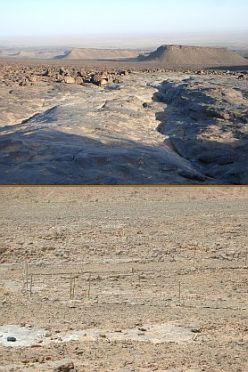 Above: Quartzite rocks at the southern slope of Jebel BaniBelow: Exclosure experiment at test site JHB
|
Observatory No.
| 104 |
Google Earth |
 Show observatory in Google Earth Show observatory in Google Earth
|
Alternative name
| JHB-Excl |
Location
| Sedementary Antiatlas |
Province
| Zagora |
Owner / Institution
| Commune de Mhamid |
Land tenure
| Communal Land |
Vegetation unit
| Saharan Rock Communities |
Precipitation per year
| 29 mm |
BIOTA Weather Station
| GLOWA-IMPETUS, test site JHB |
Local contact
| Mohamed Oubedda |
Scientific contact
| Dr. M. Finckh |
Main research
| Vegetation dynamics and climate variability |
Exclosure experiment
|
|
|
Latitude |
Longitude |
Altitude (m) |
|
Jebel Bani |
JHB-Excl |
29.93315 |
-5.63223 |
650 m |
- |
Permanent plot
|
|
|
Latitude |
Longitude |
Altitude (m) |
|
Jebel Bani |
JHBAN |
29.93475 |
-5.63364 |
651 m |
- |
Jebel Bani |
JHBAS |
29.93459 |
-5.63360 |
652 m |
- |
Jebel Bani |
JHBZN |
29.93315 |
-5.63223 |
653 m |
- |
Jebel Bani |
JHBZS |
29.93320 |
-5.63248 |
654 m |
- |
Photo album
|
 Photo album Photo album
|
|


