| Forestry and Commercial Exploitation |
| |
meta information
 |
quicklook
 |
download
 |
| Map of KFS Operations (2005) |
 |
 |
 |
| KFS Areas of Active Operations (2005) |
 |
 |
 |
| Murram Quarries (1970-2003) |
 |
 |
 |
| Map Mosaic of Forest Inventory (1974) |
 |
 |
 |
| Forest Cover Types (1974) |
 |
 |
 |
| FD Enumerations (1931-54) |
 |
 |
 |
| Map of Kakamega Sawmill Concessions (1943-70s) |
 |
 |
 |
| Kakamega Sawmill Concession (1970s) |
 |
 |
 |
| Kakamega Sawmill Concession (1943-62) |
 |
 |
 |
| Kakamega Sawmill Concession Extension (1962) |
 |
 |
 |
| Kakamega Sawmill Concession Extension Enumeration (1962) |
 |
 |
 |
| Map of Kakamega Fuel Area (1930s) |
 |
 |
 |
| Kakamega Fuel Area Concession (1930s) |
 |
 |
 |
| Kavirondo Goldmine Logging Concession (1949) |
 |
 |
 |
| Map of Kelly & Kavirondo Goldmine Sawmill Concessions (1947) |
 |
 |
 |
| Kavirondo Goldmine Logging Concession (1947) |
 |
 |
 |
| Kelly Sawmill Logging Concession (1947) |
 |
 |
 |
| Map of Risks Sawmill Concession (1937) |
 |
 |
 |
| Risks Sawmill Logging Concession (1937) |
 |
 |
 |
| Map of Rondo Sawmill Concession (1962) |
 |
 |
 |
| Rondo Sawmill Concession Extension (1962) |
 |
 |
 |
| Map of Rondo Sawmill Logging Concession (1954) |
 |
 |
 |
| Rondo Sawmill Felling Area (1954-56) |
 |
 |
 |
| Rondo Sawmill Selective Felling Area (1954) |
 |
 |
 |
| Rondo Sawmill Logging Concession (1950s) |
 |
 |
 |
| Rondo Sawmill Enumeration (1959) |
 |
 |
 |
| Map of 1st Logging Concessions (1933) |
 |
 |
 |
| 1st Logging Concessions (1933) |
 |
 |
 |
| Goldmines |
 |
 |
 |
| Map of Kakamega Goldfields (1932) |
 |
 |
 |
| Gold Prospecting Concessions (1932) |
 |
 |
 |
| Map of Kakamega Goldfield (1924) |
 |
 |
 |
| Kakamega Goldfield (1924) |
 |
 |
 |
| Promising Properties for Gold (1924) |
 |
 |
 |


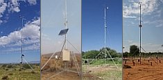
 Go to the WeatherNet