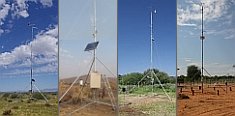 


Weather data
A large number of automatic weather stations has been implemented in the frame of the BIOTA AFRICA project by the Namibian National Botanical Research Institute (NBRI) and the Group "Biodiversity, Evolution and Ecology" (BEE) of the University of Hamburg. The website offers hourly updates of data and graphs of a large number of weather parameters.

|
 Geodata Catalogue Geodata Catalogue
< Geodata Service

The map projection of data for the levels "Africa", "Kenya" and "Uganda" is geographic, for the other levels it is UTM.
|
|
Africa and East AfricaThis level comprises a few data sets useful to demonstrate the integration of BIOTA-East within BIOTA-Africa.
|
|
|
KenyaHere a wide range of data on topography, vegetation, climate, geology and soils, etc. for all of Kenya is included. This is provided since part of the observations are spread across the country and in order to support the scaling-up of research results to a wider spatial extent.
|
|
|
Kakamega and the Nandi ForestsThis level covers 10 forests in an area of 60 km x 65 km, with Kakamega Forest and the Nandi Forests being the larger ones. Of main interest here are the data layers showing changes in land cover over time thus revealing anthropogenic interference and fragmentation of the forest cover are of main interest.
|
|
|
Kakamega ForestKakamega Forest including the forest fragments Malava, Kisere and Kaimosi represents the extent of most observations within BIOTA-East and thus our focus research area.
|
|
|
Maseno Botanical GardenHere you can find geospatial data on the layout of the Maseno University botanical garden as set-up with the help of BIOTA.
|
|
|
UgandaWith phase 2 BIOTA-East research was extended to Uganda. Therefore, for Uganda too we provide a wide range of geodata on topography, vegetation, climate, geology and soils, etc.
|
|
|
Budongo ForestThe Budongo Forest is one of the two comparison sites studied mainly in project phase 2. It is the least disturbed forest of the three forest areas investigated.
|
|
|
Mabira ForestThe Mabira Forest, found approximately half way between Kakamega Forest and Budongo Forest, makes the disturbance gradient complete.
|
|
|
Biodiversity ObservatoriesThis level facilitates the exact georeferencing and integrative analysis of the BIOTA-East plot observations.
|
|
|


 Go to the WeatherNet
 Geodata Catalogue