| |
Title |
Description |
Purpose |
Organization |
Details
PDF
|
Vegetation data, soil data and plant functional traits central Namibia |
Data from vegetation sampling on different farms in central Namibia, data for grass biomass on different farms; vegetation samples around water points; plant functional traits for > 100 plant species. |
Rangeland ecological in central Namibia |
University of Hamburg |
Details
PDF
|
Soil seed bank data and seed/diaspore traits |
Soil seed bank data from highly degraded and non-degraded rangelands in arid southern Namibia, i.e. BIOTA Observatories Gellap-Ost and Nabaos. Data on seed bank properties (species composition, seed densities), vertical and horizontal patterning, direct germination methods. Seed/diaspore traits (weight, length, width) of the 35 most common seed bank species from location. |
Assessment of below-ground land degradation and regeneration capacity towards improved vegetation states. |
BIOTA Southern Africa, University of Hamburg |
Details
PDF
|
Vegetation and environmental data |
Mapping data on vegetation types in the Keetmanshoop area, south-central Namibia. Vegetation samples from >200 plots including data on habitat and soil properties. |
Assessment of resource heterogeneity and description of veld-types. |
BIOTA Southern Africa, University of Hamburg |
Details
PDF
|
BISAP Database (Biogeographical Information System on African Plant Diversity) |
A database of botanical distribution data, including taxon name and geographic coordinates |
Biodiversity analysis for creating distribution and species richness maps etc. |
Nees Institute for Biodiversity of Plants, University of Bonn |
Details
PDF
|
Vegetation and Soil Data from the Observatories Narais and Duruchaus, Namibia, March 2009 |
Vegetation and Soil Data from the Observatories Narais and Duruchaus, Namibia, March 2009. 20 nested plots on each observatory, ranging from 0.01 to 1000 m², randomly placed across the whole square kilometre. Data were recorded for the Diploma thesis of Jan Peters, University of Greifswald |
Evaluation of species-area relationships in vegetation analysis of southern Africa. |
University of Hamburg, BioCentre Klein Flottbek and Botanical Garden |
Details
PDF
|
Utilized plant species on cacao plantations younger than 7 years |
Inventories of all plant species other than cacao on cacao plantations and assignment of utilization purposes from ethnobotanic interviews |
Study of utilization of spontaneous and introduced plant species on cacao plantations of various ages, and of the importance of these species to the peasants. |
Lab. de Botanique, Université de Cocody, Abidjan |
Details
PDF
|
Utilized plant species on cacao plantations older than 6 years |
Inventories of all plant species other than cacao on cacao plantations and assignment of utilization purposes from ethnobotanic interviews |
Study of utilization of spontaneous and introduced plant species on cacao plantations of various ages, and of the importance of these species to the peasants. |
Lab. de Botanique, Université de Cocody, Abidjan |
Details
PDF
|
Ethnobotanical polls on utilized plant species on cacao plantations |
Inventories of all plant species other than cacao on cacao plantations and assignment of utilization purposes from ethnobotanic interviews |
Study of utilization of spontaneous and introduced plant species on cacao plantations of various ages, and of the importance of these species to the peasants. |
Lab. de Botanique, Université de Cocody, Abidjan |
Details
PDF
|
Pesticide residues in soil and water |
Soil and water samples were collected in Pendjari national park, hunting zone and surrounding agricultural zone. The collected samples were analysed for pesticide residues. Information about GPS data, date of sampling and detected pesticide concentrations. |
Compilation of collection data from West Africa for analyses of biodiversity |
Laboratoire de Chimie Organique : Structure et réactivité, Departement de Chimie, UFR/SEA, Université de OUAGADOUGOU |
Details
PDF
|
Pesticide residues in non-target organisms |
Different non-target organisms (bats, amphibians, moths, ants and termites) were collected in Pendjari national park, hunting zone and surrounding agricultural zone. The collected organisms were analysed for pesticide residues. Information about specimen, GPS data, date of sampling and detected pesticide concentrations. |
Compilation of collection data from West Africa for analyses of biodiversity |
Institute of Ecological Chemistry and Waste Analysis; TU Braunschweig |
Details
PDF
|
Vegetation mapping and classification data of the communal farmland of Soebatsfontein, Namaqualand, South Africa |
Mixed soil sample dataset of 10mx10m plots from 2008 |
environmental parameters for vegetation classification |
BioCentre Klein Flottbek and Botanical Garden, University of Hamburg |
Details
PDF
|
Vegetation mapping and classification data of the communal farmland of Soebatsfontein, Namaqualand, South Africa |
Vegetation sampling dataset of 10mx10m relevés from 2007 and 2008 with |
Vegetation classification and mapping |
BioCentre Klein Flottbek and Botanical Garden, University of Hamburg |
Details
PDF
|
Ants (Hymenoptera:Formicidae) of the Kakamega Forest |
The data file lists the current known species of ants from the Kakamega Forest. The ant fauna comprises ca. 300 species. This species richness is the second highest reported from the Afrotropical zoogeographical region. The observed ant fauna can be divided into a larger group of forest habitat species and a smaller group of open habitat specialists. |
Summary of ant diversity of Kakamega Forest |
Zoological Research Museum A. Koenig |
Details
PDF
|
Geodata catalogue BIOTA-E02 |
The collection of geo-spatial datasets covers different topics and scale levels from Africa to observation plots. Every dataset comes with a meta
information file and a quicklook image. Downloading the geo-spatial data
requires a password given to BIOTA-East project partners. By the end of
2009 already more than 220 datasets were included in the geodata catalogue. The BIOTA East Africa geodata service also provides ready-to-use-maps and WebGIS applications and is available at:
http://www.biota-africa.org/East_GISWeb1_ba.php. |
Access to geodatasets of interest for BIOTA East Africa project partners; an
offline version is available within Kenya and Uganda. |
Karlsruhe University of Applied Science |
Details
PDF
|
Soils of Kakamega forest, Kenya |
Soil physico-chemical properties investigated in different scales; along a disturbance and succession gradient within 2m soil pits; in plots of 20m by 20m located at different forest sites and beneath four tree species |
To assess the role of disturbance, succession, soil depth, forest stand and individual trees on spatial heterogeneity of Kakamega forest soils. |
National Museums Kenya |
Details
PDF
|
Vegetation monitoring data of BIOTA Biodiversity Observatory S22 Quaggasfontein 478 (Soebatsfontein) |
Vegetation monitoring dataset of the BIOTA Biodiversity Observatory S22. 10mx10m and 20mx50m relevés with vegetation structure; nine years of observation |
Vegetation monitoring |
BioCentre Klein Flottbek and Botanical Garden, University of Hamburg |
Details
PDF
|
Land cover and Land cover change for the GLOWA Volta Basin |
Land cover thematic classification result at 250-meter resolution using the FAO Land Cover Classification System (LCCS) standard; LC change estimates from LCCS from 1990/1 to 2000/1 |
LCCS described to improve biodiversity estimates, Vegetation changes related to LCCS themes, including magnitudes of change to improve biodiversity and hydrological budget estimates |
University of Würzburg, DLR Remote Sensing Unit |
Details
PDF
|
Wetlands & wetland biodiversity |
Wetlands predictions and classifications according to biodiversity species abundances as well as general FAO Land Cover Classification System (LCCS) codes that is standards. |
To estimate wetland extends for surface energy balance models, to estimate water drainage patterns for hydrological models, to estimate species occurrences and habitat fragmentation as a function of wetland occurrences |
University of Würzburg, DLR Remote Sensing Unit |
Details
PDF
|
Visual Plants |
Specimen based database with images |
Collection management, GBIF provider |
University of Hohenheim, Institute of Botany |
Details
PDF
|
Vegetation data from the Richtersveld (Succulent Karoo) |
Data were sampled on five adjacent sites in 70 10x10m plots, treated with rehabilitation techniques. |
Analysing impacts of rehabilitation |
University of Hamburg |
Details
PDF
|
Tree Growth Monitoring |
Stem girth increment of 1198 trees larger 10cm DBH (diameter at breast height) was recorded monthly in Kakamega (N=817) and Budongo Forest (N=381). The trees were located in permanent sample plots (20 by 20 meters) in the BDOs as well as additionally chosen single trees. Apart from stem increment changes in the flowering, fruiting and foliage characteristics were observed. |
Characterizing and analyzing tree growth for different species in response to biotic/abiotic factors |
BIOTA East, University of Hohenheim |
Details
PDF
|
Tree seedling growth and dynamics |
Tree seedling dynamics were recorded in 192 permanent sample plots (4 m2 each) located in the BDOs in Kakamega and Budongo Forest for eight years. The monitoring was performed every three months. It included the identification of newly recruited seedlings, measurements of their height and recording of dead seedlings. Additionally highly resolved soil, light and throughfall data from the BIOTA E03 datapool were used to find relations between the plot seedling data and the spatial heterogeneity of the abiotic plot parameters. |
Characterization and analysis of tree seedling growth and dynamics in relation to abiotic factors e.g. soil, light, rain and temperature. |
BIOTA East, University of Hohenheim |
Details
PDF
|
Vegetation data from the Knersvlakte (Succulent Karoo) |
Data were sampled on four adjacent farms, which were ungrazed, moderately or intensively grazed by sheep and goats. The data were collected in 27 quartz and 24 non-quartz plots, representing two major habitat types of the region. Within each of the 1 000-m² plots, 100 subplots of 400 cm² size were sampled. |
Analysing impacts of grazing |
University of Hamburg |
Details
PDF
|
Lepidoptera of Kakamega Forest, Kenya, East Africa |
The following list reflects the current state of research into Kakamegas Lepidoptera. Well known are butterflies with 487 species (this is more than a half of all butterfly species occuring in Kenya), although there is a lack of biological information for many species.
In the last decades investigations on moth fauna of Kakamega Forest increased not least because of the BIOTA research programme. Currently there are approximately more than 600 species of moths known from the forest area plus an unknown number of Microlepidoptera species, many of them new to science. Against this background the following list has to be treated as preliminary. Future research efforts will add further species. Some Lepidoptera taxon groups as most Noctuidae and Geometridae as well as Microlepidoptera are not represented in this list yet. |
Summary of butterfly and moth diversity of Kakamega Forest |
State Museum of Natural History Stuttgart |
Details
PDF
|
Fruit flies of Kakamega Forest, Kenya, East Africa |
A total of 137 species of Tephritidae are recognized from Kakamega Forest and the surrounding area of which at least 25 (18%) are undescribed, or were so when this study began. These species represent 14 tribes and 59 genera from the four subfamilies of Tephritidae. Over half of these species are Tephritinae, most of which breed in flowers. |
Summary of species diversity of fruit flies of Kakamega Forest |
International Centre of Insect Physiology and Ecology |
Details
PDF
|
Bees of Kakamega Forest, Kenya, East Africa |
In total, about 242 bee species are known from Kakamega Forest and the surrounding agricultural areas in Western Kenya. Some of the species still need to be confirmed. They belong to the families Apidae (~92), Halictidae (~76), Megachilidae (~72), Colletidae (~6). Before the BIOTA- investigations, only 24 bee species were known for the area. Thus, most of the species are new records for the area. |
Summary of bee diversity of Kakamega Forest |
University of Bielefeld |
Details
PDF
|
Birds of Kakamega Forest |
Kakamega Forest is a hotspot of bird diversity in Eastern Africa and has been assigned an Important Bird Area by BirdLife International. In Kakamega, almost 500 bird species have been recorded of which 10% are found nowhere else in Kenya. Kakamega Forest harbours important extant populations of two globally threatened species: Turner's Eremomela (Eremomela turneri) and Chapin's Flycatcher (Muscicapa lendu). |
Summary about species diversity of birds of Kakamega Forest |
Johannes-Gutenberg University Mainz |
Details
PDF
|
Dragonflies of Kakamega Forest |
A total of 72 dragonfly species, representing 42 % of Kenyas dragonfly fauna, has been recorded from Kakamega Forest. They represent by the families Aeshnidae (7 spp.), Calopterygidae (2 spp.), Chlorocyphidae (4 spp.), Coenagrionidae (11 spp.), Corduliidae (2 spp.), Gomphidae (10 spp.), Lestidae (2 spp.), Libellulidae (33 spp.), and Protoneuridae (1 sp.). Three of these are based on literature records only (Phyllomacromia kimminsi, Neurogomphus pinheyi, and Paragomphus alluaudi). The habitat preference and affiliation with other African regions is listed for all species. The dragonfly fauna of the Kakamega Forest is impoverished compared to more western Guineo-Congolian rain forest areas. Twenty species are of national importance for Kenya, since they are only found at this site within the country. |
Summary of species diversity of dragonflies of Kakamega Forest |
Zoologisches Forschungsmuseum A. Koenig |
Details
PDF
|
Reptiles of Kakamega Forest, Kenya, East Africa |
In total, 61 reptile species are known from Kakamega Forest, Western Kenya. These include 1 turtle species (Pelomedusidae), 24 lizards (Agamidae, 3 spp.; Chamaeleonidae, 5 spp.; Cordylidae, 1 sp.; Gekkonidae, 4 spp.; Lacertidae, 2 spp.; Scincidae, 8 spp.; Varanidae, 1 sp.) and 36 snakes (Atractaspididae, 1 sp.; Colubridae, 23 spp.; Elapidae, 4 spp.; Typhlopidae, 2 spp.; Viperidae, 6 spp.). During the BIOTA project one agamid species (Agama finchi Böhme et al. 2005) was new described from the vicinities of Kakamega Forest. |
Summary of species diversity of reptiles in Kakamega Forest |
University of Trier |
Details
PDF
|
Amphibians of Kakamega Forest, Kenya, East Africa |
In total, 24 amphibian species are known from Kakamega Forest, Western Kenya. They belong to the families Bufonidae (2 spp.), Dicroglossidae (1 sp.), Arthroleptidae (2 spp.), Hyperoliidae (8 spp.), Ranidae (1 sp.), Pipidae (1 sp.), Phrynobatrachidae (3 spp.), Pyxicephalidae (1 sp.), and Ptychadenidae (5 spp.). During the BIOTA East-Africa project, one frog species (Leptopelis mackay Köhler et al. 2006) was new described. The species is endemic to Kakamega Forest and its vicinities. Two species represent new records for Kakamega Forest. |
To summarize the present knowledge about the frogs of Kakamega Forest. |
Zoologisches Forschungsmuseum A. Koenig |
Details
PDF
|
Data on Kakamega-BDOs |
Habitat fragmentation and degradation are important drivers of biodiversity loss, but little is known about their combined effects on the diversity of plant and animal taxa and on ecosystem processes like decomposition, pollination, predation, seed dispersal, and seedling establishment. Here, we present a dataset from Kakamega Forest (Kenya) including various animal and plant taxa and related ecological processes. In 2001, biodiversity observatories (BDOs) of 1 km² had been established in 11 forest sites, five in the main forest and six in adjacent fragments, by the BIOTA East Africa Project. Between 2001 and 2009, biodiversity and process data have been collected in standardized designs along regular transects in the BDOs. The data presented here have recently been integrated into a multi-taxa and process analysis to gain insight into the effects of habitat fragmentation and degradation on biodiversity and ecosystem processes. |
Overview of biodiversity and process data |
Johannes-Gutenberg University Mainz |
Details
PDF
|
Permanent Monitoring Plots in Southern Morocco (Drâa Catchment) |
35 individual-based permanent monitoring plots along a transect from the High Atlas in the Sahara. Plots distributed on 10 test-sites with exclosure experiments. Plots of 100 m² each, divided in a 0.25 m² grid. |
Vegetation monitoring, population analyses. |
BioCentre Klein Flottbek and Botanical Garden, University of Hamburg |
Details
PDF
|
BIOTA Observatories in Southern Morocco (Drâa Catchment) |
Two BIOTA Observatories in the Drâa catchment. Relevés at the 100 m² scale, vegetation structure at the 1000 m² scale, species lists at the 10000 m² scale. |
Vegetation monitoring |
BioCentre Klein Flottbek and Botanical Garden, University of Hamburg |
Details
PDF
|
Vegetation relevés in Southern Morocco (Drâa Catchment) |
868 vegetation relevés throughout the upper and middle (Drâa Catchment). Plot size generally 100 m². |
Vegetation classification, Vegetation mapping |
BioCentre Klein Flottbek and Botanical Garden, University of Hamburg |
Details
PDF
|
BIODAT |
Specimen based database |
Collection management, BIOCASE- & GBIF provider |
Zoologisches Forschungsmuseum Alexander Koenig (ZFMK) |
Details
PDF
|
Burkina Faso collections database |
Digitized collections of the Herbarium Ouagadougou (OUA), partly collected and/or digitized in the course of BIOTA. |
Compilation of collection data from Burkina Faso for analyses of biodiversity, taxonomy, biogeography (e.g., distribution models), macroecology, phytosociology, etc. and collection management |
University of Ouagadougou |
Details
PDF
|
Termites: Macrotermes bellicosus in West Africa, Benin |
Termite (Macrotermes bellicosus) mound mapping data |
analysis of population genetics & dynamics |
University of Onsabrück, Behavioral Biology |
Details
PDF
|
Burned area map in West Africa savanna |
High resolution mapped area using burned severity |
Biodiversity modelling, vegetation structure |
DLR/University Wuerzburg |
Details
PDF
|
Hyperspectral Imagery |
Hyperspectral Image taken by HyMap Sensor in April 2004 (wet season).
Spatial Resolution: 5x5m, Spectral Resolution: covering 450nm to 2500nm with bandwithh between 10nm-20nm. 126 Channels |
Extracting structural and biophysical parameters from Imagery, e.g. vegetation indices; vegetation mapping; regression modelling, species distribution modelling |
University of Hamburg |
Details
PDF
|
Capture data of bats in Pendjari Region, Atacora District, Bénin |
Bat inventory and monitoring using standardized protocol on BIOTA Biodiversity Observatories (BOs) in Benin, including data on taxonomy (family, genus, species), locality (incl. coordinates), individual field number, date & time, method, standard measurements (body mass, forearm length), sex, age, reproduction, observer, recaptures. |
Comparison of bat communities in protected vs. disturbed areas, species inventory of protected areas, long-term monitoring in standardized plots (BOs), analysis of diversity patterns from local to regional scales |
Laboratoire d'Ecologie Appliquée, FSA, Univ. Abomey-Calavi |
Details
PDF
|
Collection of bat specimens from Pendjari Region, Atacora District, Bénin for reference collection |
Voucher specimens preserved in alcohol and stored in collections at Univ. of Abomey-Calavi & Ulm, including information on specimens [family, genus, species, sex, age, F-N°, measurements (Bm, FA, H&B, Tail, Ear, Tra, 3Met, 3Ph1, 3Ph2, 3Ph3, 4Met, 4Ph1, 4Ph2, 5Met, 5Ph1, 5Ph2, Tib, HF-, HF+, C-C, M3-M3, C-M3), reproductive status, collector, collection, locality / habitat of capture, coordinates, etc]. |
Zoological reference collection for local capacity building in bat species identification, training & teaching and as vouchers of bat records |
Laboratoire d'Ecologie Appliquée, FSA, Univ. Abomey-Calavi |
Details
PDF
|
Fruit resources use by flying foxes in Pendjari Region, Atacora District, Bénin |
Faecal samples of flying foxes from BIOTA Biodiversity Observatories (BOs) in Benin, including information on fruits (different species), fruit bat (genus, species, sex & age), BO number, date of data collection. |
Inventory and monitoring of food resources to assess important plant species for long-term conservation of flying foxes in these areas. |
Laboratoire d'Ecologie Appliquée, FSA, Univ. Abomey-Calavi |
Details
PDF
|
Phenology of selected bat-dispersed tree species in Pendjari Region, Atacora District, Bénin |
Phenology of selected bat-dispersed trees using be-weekly monitoring on BIOTA Biodiversity Observatories (BOs) and their vicinity, including regular estimation of different organs (leaves, flowers & fruits), date of caensus. |
Estimation of food resource availability in protected vs. disturbed areas to assess land use effect on the resource production for fruit bats in this region. |
Laboratoire d'Ecologie Appliquée, FSA, Univ. Abomey-Calavi |
Details
PDF
|
Shea trees stand and spatial distribution inventory in Pendjari Region, Atacora District, Bénin |
Shea trees stand structure inventory on BIOTA Biodiversity Observatories (BOs) in Benin, including individual number of trees, sites name (incl. coordinates & coordinate system), dendrometric measurements of individual trees (height [m], crown radius [m], diameter at breast height [dbh in cm]), age class. |
Comparison of shea trees spatial distribution pattern and population structure in protected areas vs. disturbed areas, land use changes inventory, ecosystem conservation. |
Laboratoire d'Ecologie Appliquée, FSA, Univ. Abomey-Calavi |
Details
PDF
|
Hydrological modelling Comoé |
Digitization of the complete flowing water system in the entire area, definition of flow direction, of streams, of catchment areas, of watersheds, of adjoint catchment areas and of raindrop paths |
Creation of a hydrological network of the southern Comoé National Park and the adjacent utilized area south of the park and assignment of stream properties to all sections of the watercourses |
Dep. of Botany, University of Rostock |
Details
PDF
|
Atmospheric correction Comoé |
Radiometric correction of seven satellite images: determination of radiance, of apparent reflectance and of relative reflectance |
Atmospheric correction of the Landsat, SPOT and ASTER satellite images covering the southern Comoé National Park and the adjacent utilized area south of the park used for vegetation classification and generation of maps |
Dep. of Botany, University of Rostock |
Details
PDF
|
Vegetation maps Comoé |
Principal Component Analysis of seven satellite images, multi-temporal unsupervised classification, verification by means of aerial photographs and field data, creation of GIS maps of selected single vegetation classes |
Creation of generalized maps of the vegetation cover and selected ecosystems of the southern Comoé National Park and the adjacent utilized area south of the park. Differentiation of gallery forest, island forests and the principal savanna types. |
Dep. of Botany, University of Rostock |
Details
PDF
|
Termites and Ants database |
A database of soil arthropod inventories: termites and ants. Using a combined, standardised rapid assessment protocol (RAP) for the diversity assessment, BIOTA standard (e.g. biodiversity observatories in Burkina Faso, Benin, Cote d'Ivoire), species lists, community composition (functional groups/guilds). With site parameters. |
Compilation of relevé data in West Africa for analyses of biodiversity. |
Zoology III; Biocenter; Universität Würzburg |
Details
PDF
|
Fangdaten 2003-2005 W07 |
Data from fish caught during the respective period |
Registration of field data |
Zoologie III, Biozentrum, Universität Würzburg |
Details
PDF
|
Einzeldaten E-Fische 2005 |
Electric organs discharge (EOD) recordings from weakly electric fish from West Africa - original data as text-files |
Survey of EOD-diversity |
Zoologie III, Biozentrum, Universität Würzburg |
Details
PDF
|
E-Fische 2005 incl Auswertung |
Electric organs discharge (EOD) recordings from weakly electric fish from West Africa, already analysed |
Survey of EOD-diversity |
Zoologie III, Biozentrum, Universität Würzburg |
Details
PDF
|
Fangdaten 2003-2005 W07 |
Data from fish caught during the respective period |
Registration of field data |
Zoologie III, Biozentrum, Universität Würzburg |
Details
PDF
|
Wetlands & wetland biodiversity 2001-2004 |
Wetlands predictions and classifications according to biodiversity species abundances as well as general FAO Land Cover Classification System (LCCS) codes that is standards. |
To estimate wetland extends for surface energy balance models, to estimate water drainage patterns for hydrological models, to estimate species occurrences and habitat fragmentation as a function of wetland occurrences |
University of Würzburg, DLR Remote Sensing Unit |
Details
PDF
|
Land cover & Land cover change |
Land cover thematic classification result at 30-meter resolution using the FAO Land Cover Classification System (LCCS) standard; LC change estimates from LCCS from 1990 to 2000 (anticipated: LC change extended to include 2005/6 at 225-meter resolution) |
LCCS described to improve biodiversity estimates, Vegetation changes related to LCCS themes, including magnitudes of change to improve biodiversity and hydrological budget estimates |
University of Würzburg, DLR Remote Sensing Unit |
Details
PDF
|
Tree Density Map |
Map describing tree density derived from different scaled remote sensing data by linear spectral unmixing. |
Estimation of the possibility to detect biodiversity change with satellite data more exact. |
Lehrstuhl für Fernerkundung, Universität Würzburg |
Details
PDF
|
Fragmentation Products |
Fragmentation Indices for Western Africa |
Biodiversity modelling |
DLR |
Details
PDF
|
VegDa vegetation database |
A database of botanical inventories, including Braun-Blanquet, BIOTA standard (e.g., biodiversity observatories in Benin and Burkina Faso), simple species lists. With site parameters and additional species informations. |
Compilation of relevé data in West Africa for analyses of biodiversity, biogeography (e.g., distribution models), macroecology, phytosociology, etc. |
Forschungsinstitut Senckenberg; Universität Frankfurt |
Details
PDF
|
West Africa collections of the SeSam database |
Digitized collections of the Herbarium Senckenbergianum (FR), partly collected and/or digitized in the course of BIOTA. Most of this data is available up to date and online via http://sesam.senckenberg.de/. The dataset is contributing to GBIF. |
Compilation of collection data from West Africa for analyses of biodiversity, taxonomy, biogeography (e.g., distribution models), macroecology, phytosociology, etc. and collection management |
Forschungsinstitut Senckenberg; Universität Frankfurt |
Details
PDF
|
BISAP Database (Biogeographical Information System on African Plant Diversity) |
A database of botanical distribution data, including taxon name and geographic coordinates |
Biodiversity analysis for creating distribution and species richness maps etc. |
Nees Institute for Biodiversity of Plants, University of Bonn |
Details
PDF
|
Forest dynamics Comoe |
Direct comparison of corresponding aerial photographs from 1954 and 1996 |
Study on dynamics of 654 forest islands occurring between 1954 and 1996 in the southern Comoé National Park and the adjacent utilized area south of the park. |
Dep. of Botany, University of Rostock |
Details
PDF
|
Forest cutting Comoe |
Change detection procedures after supervised and unsupervised classifications of a Landsat TM (1988) and an ETM+ (2002) image |
To detect areas of deforestation, reforestation and of potential forest cover (if no cutting had occurred) in the southern Comoé National Park and the adjacent utilized area south of the park. |
Dep. of Botany, University of Rostock |
Details
PDF
|
Forest changes dry-rainy season Comoe |
Change detection procedures after supervised and unsupervised classifications of ASTER image (dry season, jan. 2002) and SPOT image (rainy season, nov. 1996) |
To detect foliation differences at forest islands between dry and rainy season, and to distinguish forest-border communities dominated by Anogeissus leiocapus in the southern Comoé National Park and the adjacent utilized area south of the park. |
Dep. of Botany, University of Rostock |
Details
PDF
|
Dynamics of unvegetated surfaces Comoe |
Direct comparison of corresponding Corona satellite images from 1967 and aerial photographs from 1996 |
Study on dynamics of 913 unvegetated surfaces occurring in 1967 and 1996 in the southern Comoé National Park and the adjacent utilized area south of the park. |
Dep. of Botany, University of Rostock |
Details
PDF
|
Soil studies Comoé |
Several soil transects studied with physical analysis of soil profiles or drillings in the evergreen gallery forest of the Comoé river, semi-deciduous island forests and savanna. Relation of the soil data to data recorded on the elevation relief and the vegetation along the transects. |
Comparative study of soil properties under savanna, island forest and gallery forest in the semi-natural forest-savanna mosaic of the southern Comoé National Park to detect relationships between the vegetation pattern and soil characteristics |
Dep. of Botany, University of Rostock |
Details
PDF
|
Core area analysis |
Stepwise calculation of core areas and relative core areas of forest islands in the southern Comoé National Park with forest boundary zones (buffers) varying from 5 to 350 m. |
Analysis of forest core areas in a semi-natural forest island mosaic assuming a varying width of the forest boundary zone for different species |
Dep. of Botany, University of Rostock |
Details
PDF
|
Terminology, application and abundance of medicinal plants |
Scientific and vernacular names of medicinal plants in the Ouassa-Pehunco area of Northern Benin, healer's local perception about current abundance and future threats of medicinal plants |
Ethnological research about the use of plants for medicinal purposes |
Dept. of Anthropology and African Studies, University of Mainz |


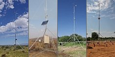
 Go to the WeatherNet